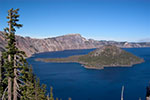
January 3, 2006; by Igor Polk, San Francisco Click
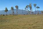
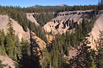
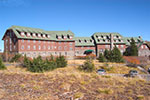
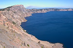
Helpful links: • San Francisco; • Crater Lake Information by USGS
Location of the Crater Lake National Park: South Oregon. 1-2 hours drive from freeway 5. Close to highway 97. Other attractions in the area: Ashland, Newberry National Volcanic Monument, Columbia River, Mount Shasta, Portland Tango Clubs. |
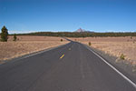
Click on a picture below to start the tour from that location (use small images is for slow connections): |
The tour starts here. North to Klamath Falls, highway 97, then 62 lead us to Crater Lake National Park. Sugar pines surround the road as soon as it enters the forest. |
|
The road goes along the Annie Creek canyon. The canyon and the remnants of Mount Mazama volcano are well observed. 7700 years ago Mount Mazama 3,600 m tall (12,000 ft) erupted pouring 50 cubic km of lava and ash. The magma chamber beneath the mountain drained. As the underlying support for the mountain was lost, the walls of the volcano collapsed inward. So, Mount Mazama became Crater Lake... In the canyon along with basalt walls you can see pinnacles formed when the creek eroded ash around fossil fumaroles. |
|
Crater Lake Lodge meets you at the end of the road. The Lodge stands right at the edge of the lake. This is a comfortable place surrounded by majestic views. |
|
Crater Lake, at 1,943 ft (592 m) deep, is the deepest in the US. It is about 5 miles (8 km) in diameter, and is surrounded by steep rock walls that rise up to 2000 ft (600 m) above the lake's surface. Wizard Island in the lake is a caldera which rises 764 ft (233 m) above the lake's surface. Here you will see panorama pictures of the lake and its rocky walls. |
|
Continuing the tour around the lake we come to another place where we can see the lake. Yes, water is that blue. We are about 400 m above the lake level. The island is 233 m tall. Lake depth is up to 600 m. We are 1 km (3300 ft) above the bottom! Many things seem different than they are. Almost whole San Francisco can fit inside this crater! |
|
We are crossing Pumice Desert heading north. The empty areas are pumice deserts formed by volcanic ash and avalanche deposits. "Pumice Desert is composed chiefly of pumice and scoria ejected by Mt. Mazama. Pumice is light-colored, porous, and extremely lightweight. Scoria is often reddish, and noticeably darker and heavier." |
Subscribe to get notified about a new tour
Check out the Gue
Here are more tours containing wiggle stereo images, pictures, and photos:
SBC Park (110 photos) | Conservatory of Flowers in the Golden Gate Park (37 stereo pictures) | Robot Exhibition (50 stereo images) | Crater Lake (8 stereo photos) | Embarcadero Center (9 stereo images) | University of San Francisco (4 stereo)
More Virtual Tours ( not Stereo ) |
|||
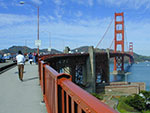
Walk along Golden Gate Bridge, |
Go to and all around Alcatraz, |
All around San Francisco.. |
..and more! Do not miss new tours: subscribe! |
Copyright©2005 Yes San Francisco, LLC. All rights reserved. Copying of images, or their parts, or any other content is prohibited.